We continue to travel in search of alien places on our planet. These amazing places can be found on all continents of the globe. Images enlarge when you click on them. We wish you a pleasant viewing!
Reynisfjara beach, Iceland
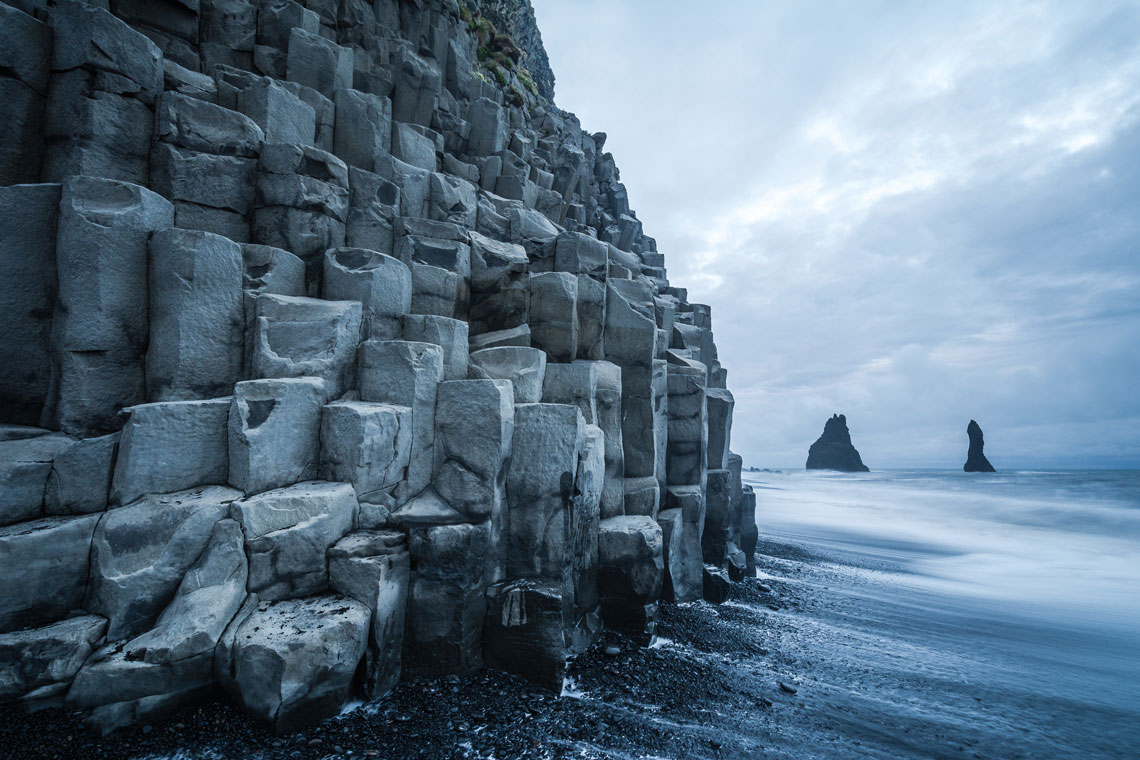
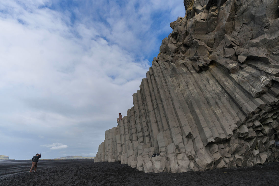
Reynisfjara Beach (also known as Black Beach) is located near Vik in South Iceland. This place is very popular among tourists and photographers because it looks mystical, mesmerizing and at the same time frightening. This is because the sand on the beach is black, and on the sand there are frightening black basalt columns. Looks quite alien!

Black Beach appeared thanks to volcanic lava, which hundreds of years after the volcanic eruption, the sea waves crushed and crushed into sand. Here, as a result of the interaction of volcanic lava and sea water, unusual faceted columns arose.
We have already considered similar amazing basalt formations. For example:
- The Giants' Road (or "The Causeway of the Giants") in Northern Ireland
- Svartifoss waterfall (or black waterfall) in Iceland
- natural monument of world importance Cape Stolbchaty in Russia
- Reynisfjara beach in Iceland
- Takachiho Gorge in Japan
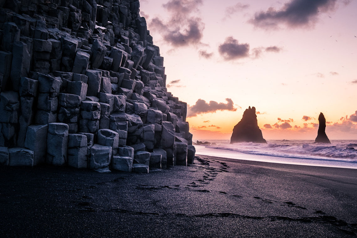
The length of Reynisfjara beach is about 5 kilometers, and the width reaches several tens of meters. But tourists do not come here to sunbathe and swim, but mostly to take a walk and take pictures of its unearthly landscapes. In 1991, the American magazine Islands Magazine named this beach one of the most beautiful non-tropical beaches on Earth.
According to the reviews of tourists who have been here, when visiting this beach, a variety of feelings arise – from indescribable admiration to fear and goosebumps. Due to its unusual appearance, little reminiscent of earthly landscapes, Reynisfjara Beach often attracts directors who make science fiction films.
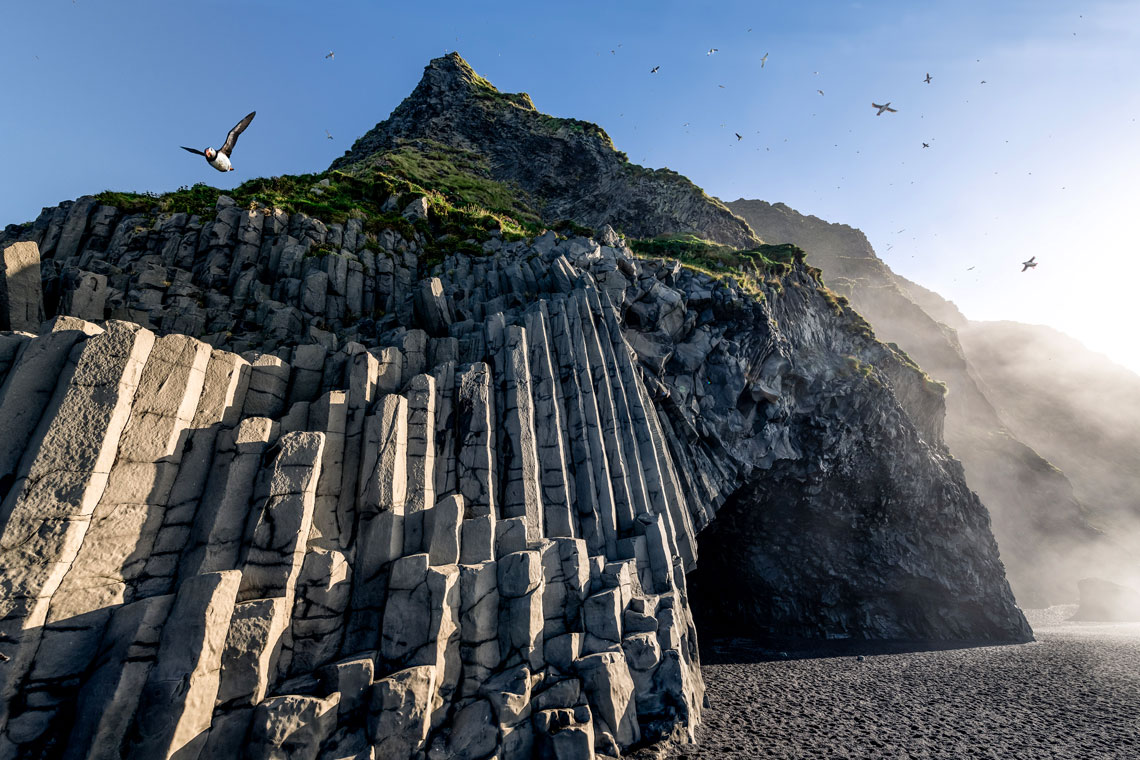
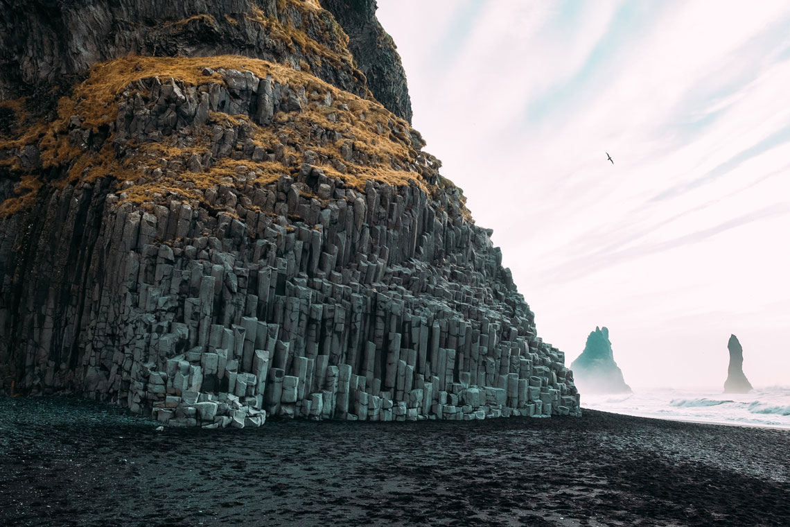
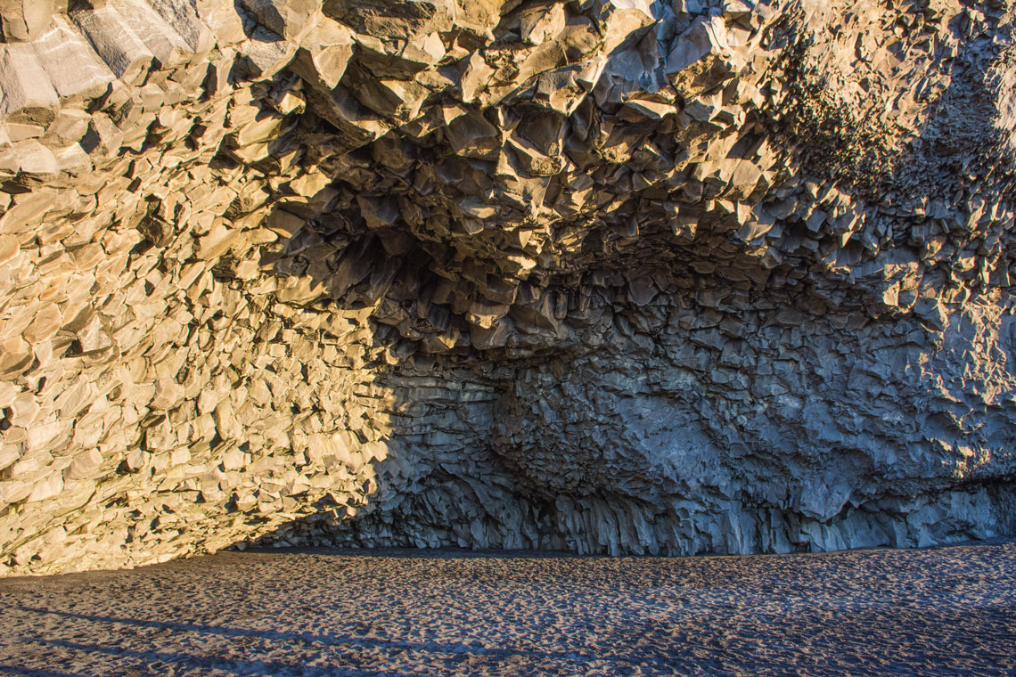
On the eastern side of the Black Beach is the famous mountain Reynisfjall with arched caves and basalt columns, which offer stunning views of the surroundings. The mountain is popular with ornithologists due to the fact that many different species of birds live in its crevices.
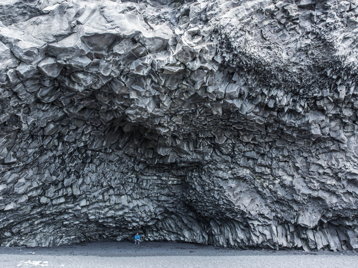
The largest cave of the mountain is Halsanefshellir Cave, which is an unusual and interesting grotto that can be entered directly from the shore. It is located just behind the basalt pillars descending to the ocean, on which tourists love to take pictures. It was in this cave that one of the scenes from the film "Noah" directed by Darren Aronofsky was filmed.
The locals have a joke: "If you don't like the weather, wait 5 minutes, it will get worse." The sun is not a frequent visitor here and it is very quickly replaced by heavy thunderclouds, rains, and rains – downpours, and then there may be fog. Locals claim that it rains here 340 days a year, and the thermometer in July rarely shows above +15 °C.
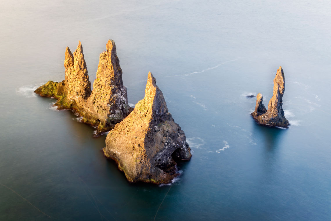
Near Mount Reynisfjall are the famous basalt kekurs (cone-shaped rocks) – Reynisdrangar. They are several tens of meters away from the beach of Reynisfiyara and are washed by the waters of the Atlantic Ocean. According to one of the local legends, these picturesque pillar-shaped rocks appeared when two trolls tried to pull a three-masted ship ashore, which had run aground. But as the sun rose, daylight broke through the clouds and the trolls petrified to form kekurs.
Goblin valley, usa
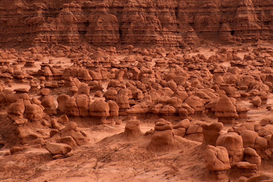
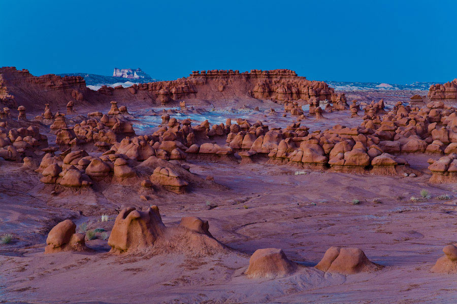
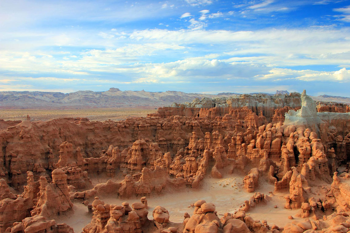
Goblin Valley (translated from English as "Goblin Valley") is one of the 43 parks in Utah, USA. It is located in the central part of the state in Emery County. The main attraction of Goblin Vali is thousands of mushroom-shaped hoodoos, which the locals call goblins.
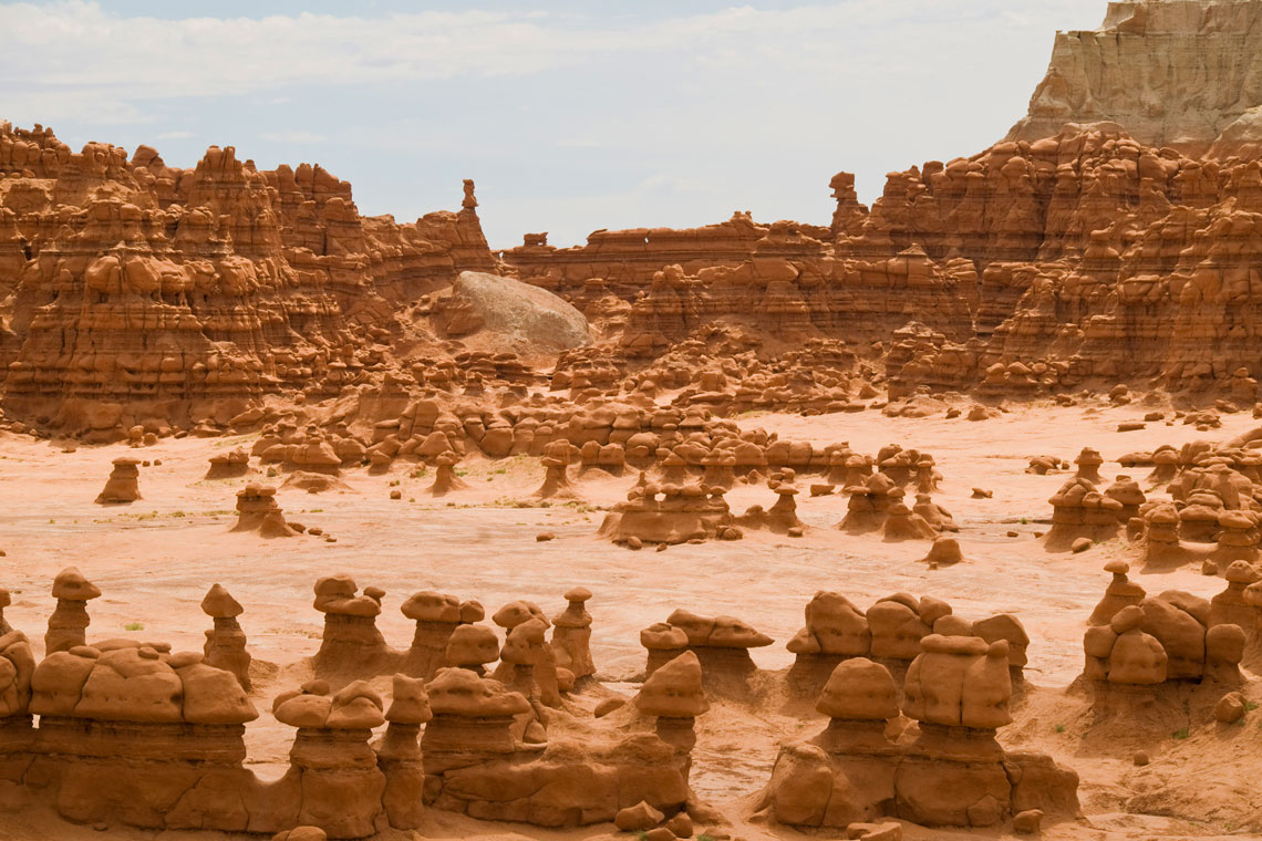
The amazing shapes of these rocks are the result of an erosion-resistant layer of rock on relatively soft sandstone. In other words, these unusual stone forms, which are several meters high, arose as a result of the weathering of sand that lay between solid rocks.
The rocks indicate that they are close to the edges of an ancient sea with ebb and flow, tidal channels that channel currents back into the sea, and coastal sand dunes. The Entrada sandstone from which the hoodoos formed was deposited during the Jurassic period about 170 million years ago.
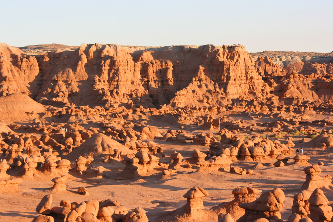
The flora of Goblin Valley includes Mormon tea, Russian thistle, rice grass, and various cacti, as well as junipers and pines at higher elevations. Fauna includes rabbits, scorpions, kangaroo jumpers, pronghorn antelopes, foxes, vipers and coyotes.
Goblin Valley was featured in the 1999 science fiction comedy Galaxy Quest as an alien planet. The bizarre hoodoos in the valley inspired the creation of the fictional stone monsters of the planet.
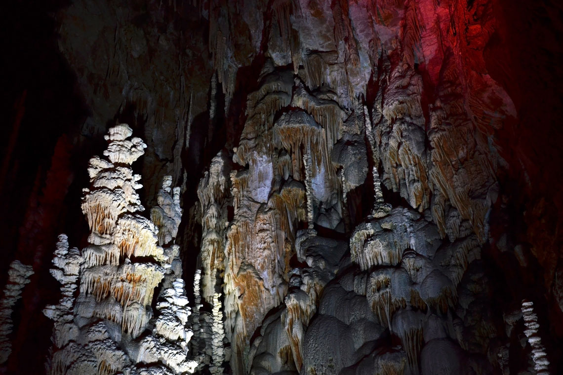
Aven Armand Cave, France
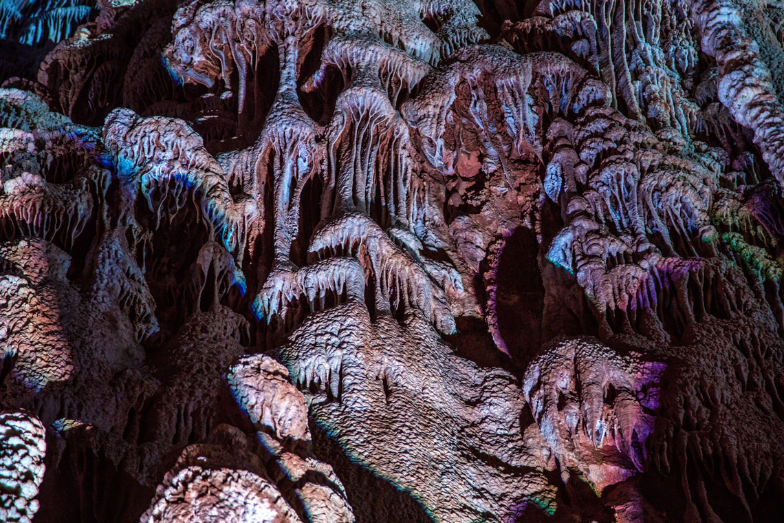
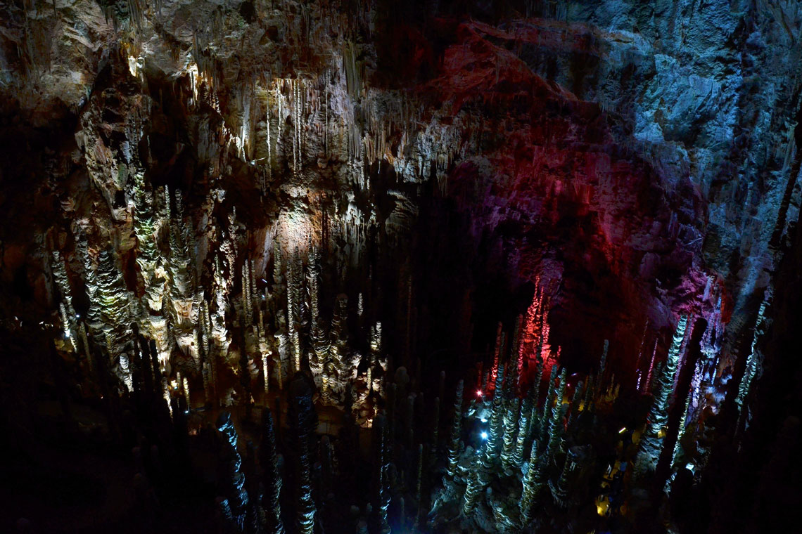
Aven Armand is a limestone cave located in the Cévens National Park of France, in the Lozère department. The cave is known for containing the world's largest stalagmites of the most bizarre shapes.
The cave starts as a narrow pit that goes down 75 meters, then turns into a huge cave known as the "Great Hall". The Great Hall is about 100 meters long and 55 meters wide.
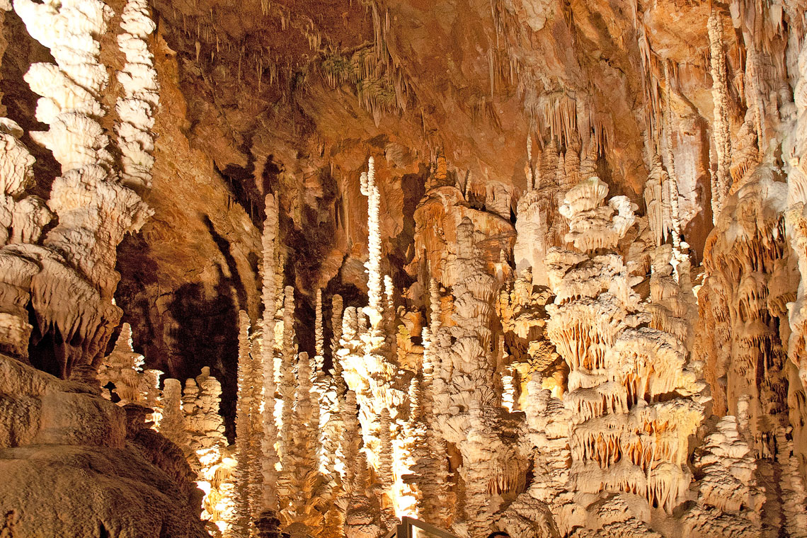
The floor is covered in many fragile limestone formations of various shapes and sizes, created by the slow dripping of water through the stone over millennia. Some of these stalagmites reach a height of 30 meters.
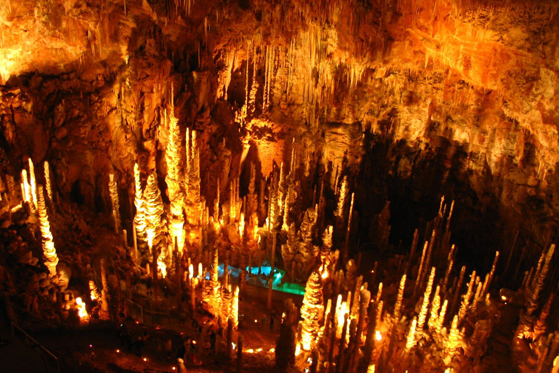
Aven Armand was first scientifically studied by French explorers Louis Armand and Edouard-Alfred Martel in 1897. However, the cave has only been open for tours since 1927, after artificial tunnels and footpaths were created here to provide tourists with easy access to the Great Hall. A funicular was also installed here, which makes it easy to get to the cave, including people with disabilities.
In June 2017, French singer Nolwenn Leroy used the Aven Armand cave as the location for the music video for her single "Gemme".
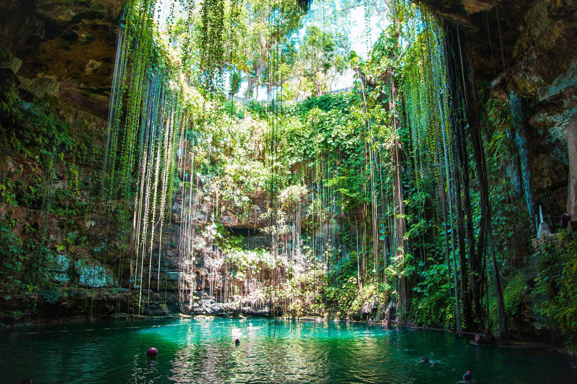
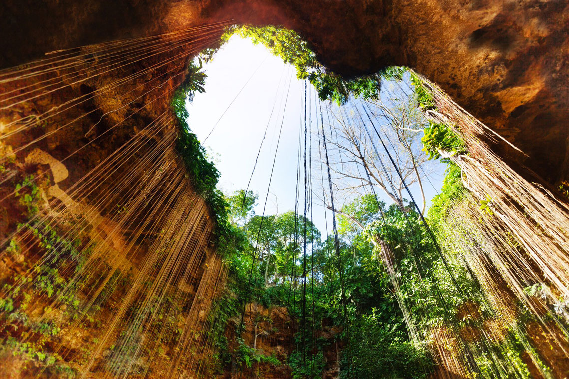
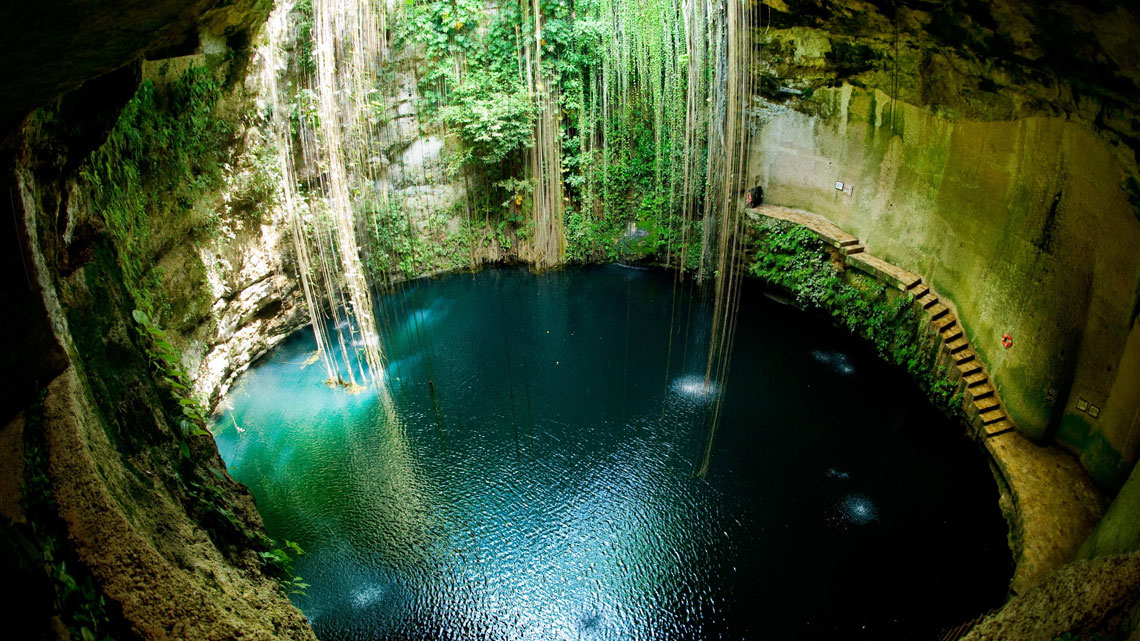
Cenotes, Mexico
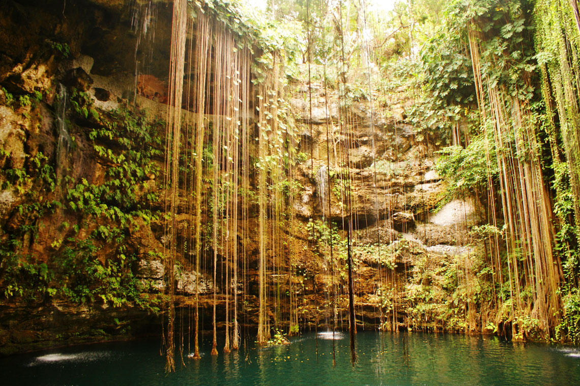
Cenotes are special karst formations, natural failures formed during the collapse of the vaults of limestone caves in which underground water flows. These can be lakes, wells and entire cave complexes with underground rivers and, at times, access to sea water. Cenotes are found on the Yucatan Peninsula in Mexico and nearby Caribbean islands.
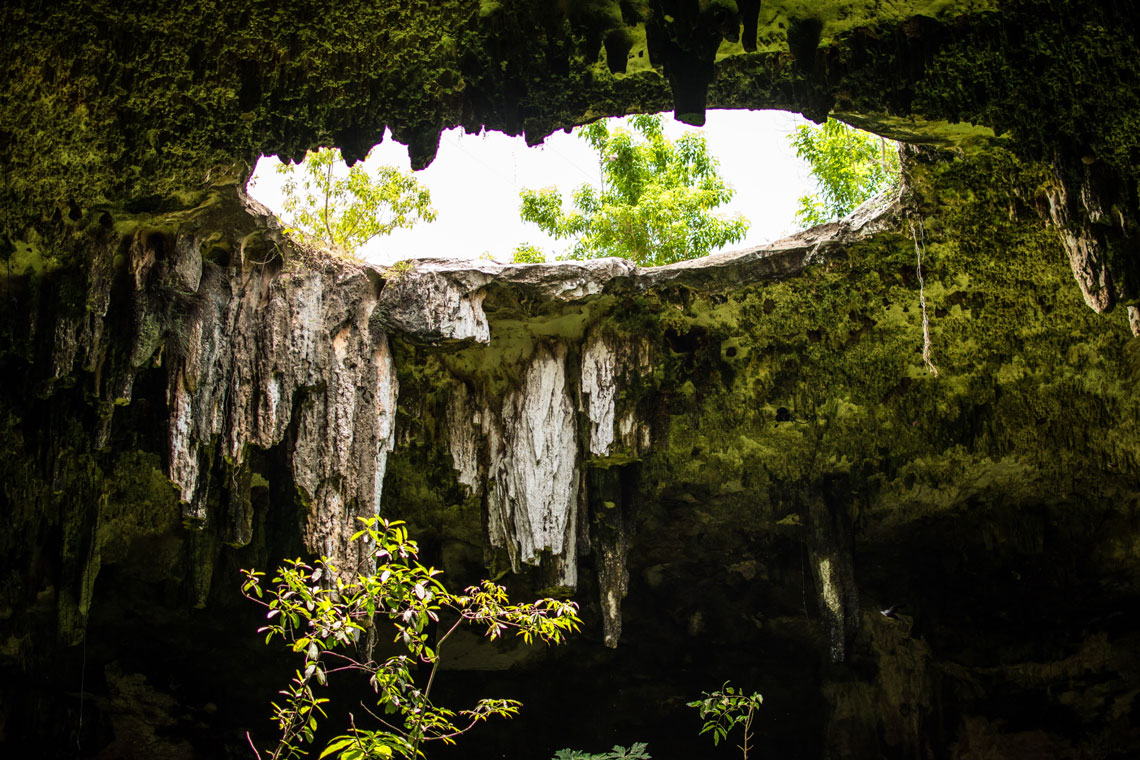
The Yucatan Peninsula is entirely composed of limestone rocks. There are practically no rivers here, few lakes (and if there are, they are almost certainly swampy), but the Yucatan Maya Indians did not lack clean fresh water – they had sacred cenotes. As a result of the long erosion of limestone and the periodic changes in the water level in the oceans, the entire Yucatan, like Swiss cheese, was riddled with holes and channels.
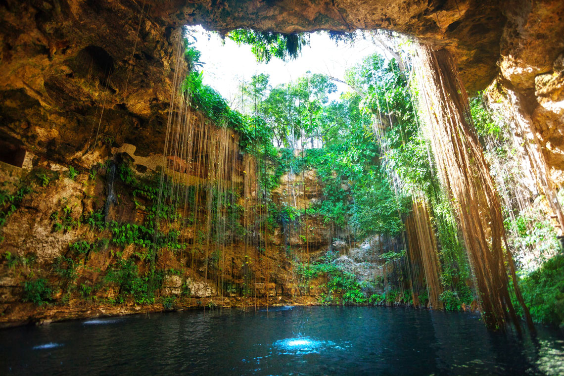
From the surface, a typical cenote looks like a smooth round well, in which water is visible somewhere below. The Indians call such cenotes "mouths" or "eyes." And indeed, the wells make some kind of unearthly impression.
The Maya were very kind to the cenotes, they did not just take water there. According to them, cenotes are the entrances to the otherworldly, dark world. Archaeologists find human remains in some cenotes – bloody sacrifices were made to the cenotes.
Meanwhile, scientists explain the formation of even round holes simply: when the water level drops in an underground cave filled with water, the roof of the cave collapses inward. The water temperature in almost all cenotes is even and constant – 24-25 °C.
Some cenotes have become established diving centers. The most famous of them is Dos Ojos (Spanish for "Two eyes"). Exploration of the caves only began in 1986 and is now a world class dive site, along with the Great Blue Hole of Belize.
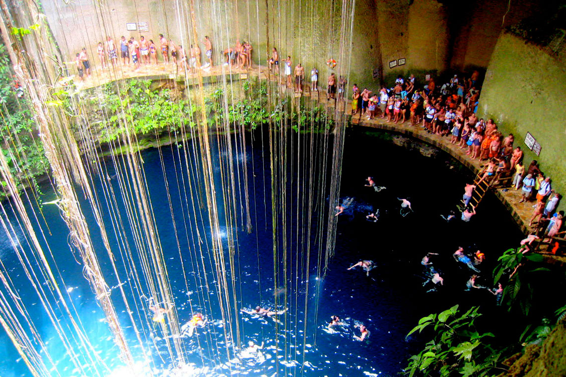
What attracts divers in cenotes? First of all, uniqueness. Engage in cave diving in huge cave systems (the total length of the caves of the Dos Ojos cenote alone, for example, is more than 213 km), see huge stalactites and stalagmites, follow the light effects, mysterious enchanting rays breaking through the water from somewhere above, travel under the roots of the tropical forest in water so transparent that it is indistinguishable from air, and in places where salty ocean water meets fresh water, see an optical phenomenon – a halocline.
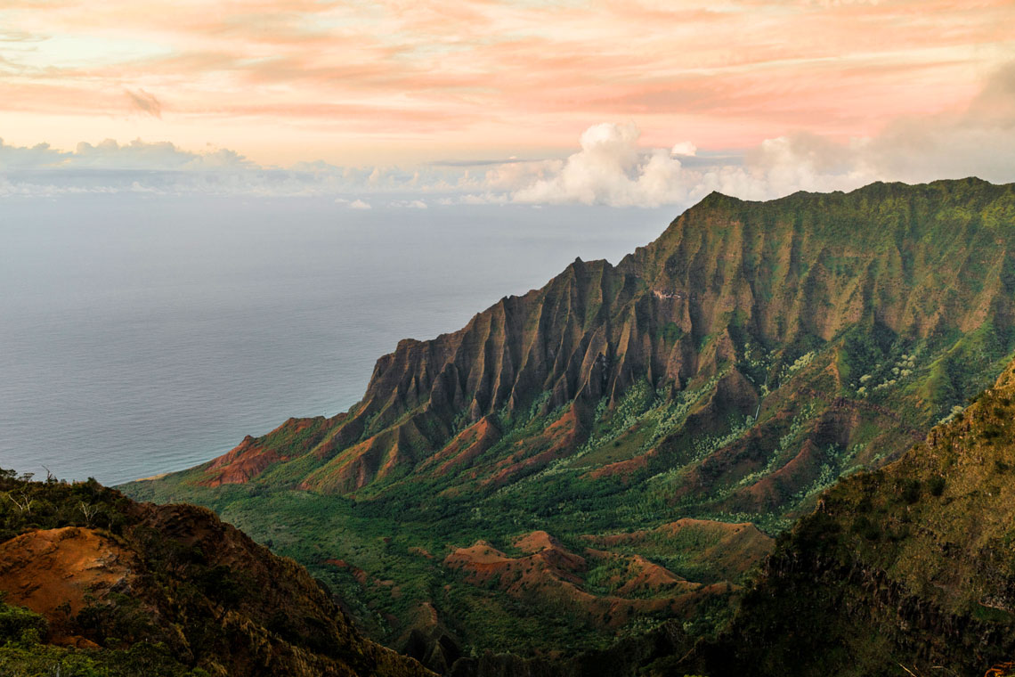
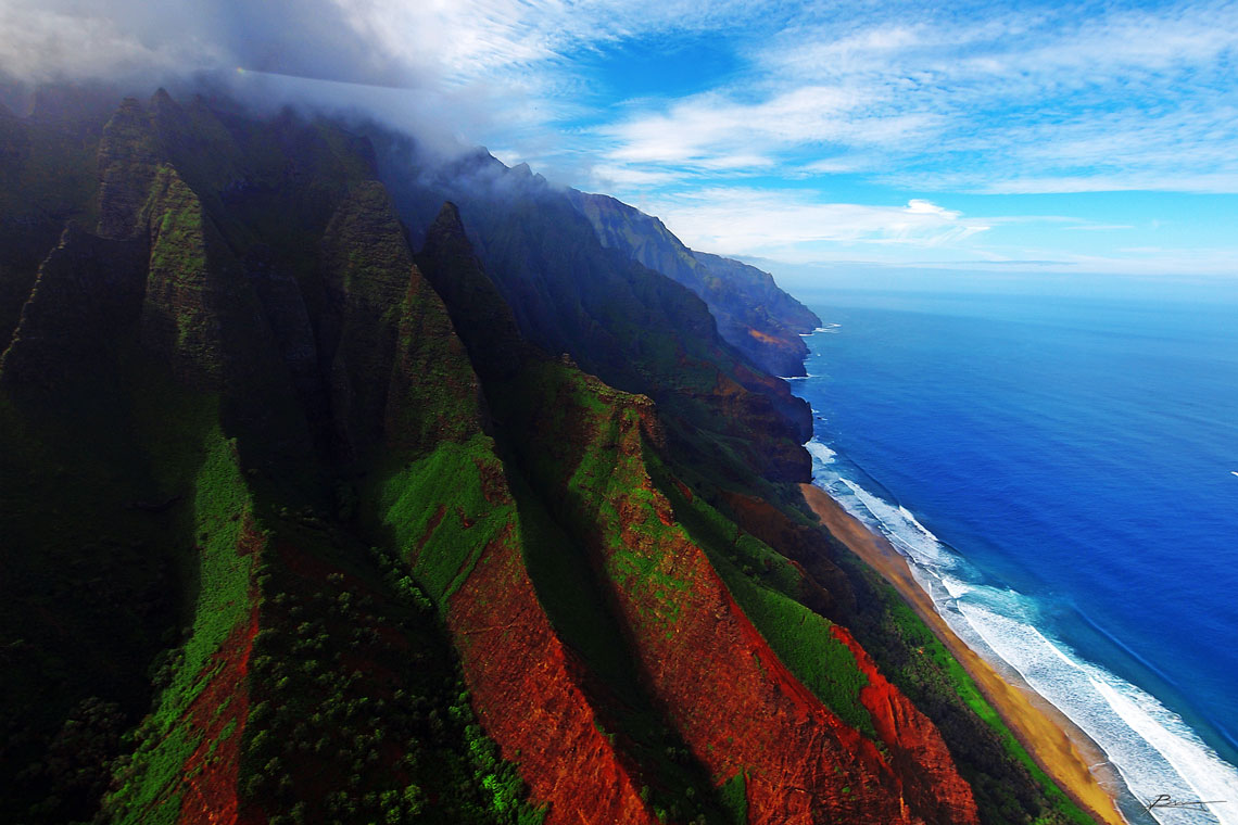
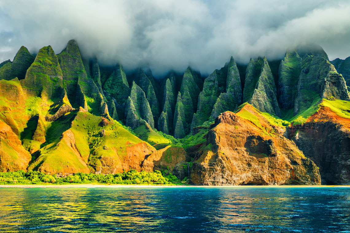
Coast of Kauai island, Hawaii, USA
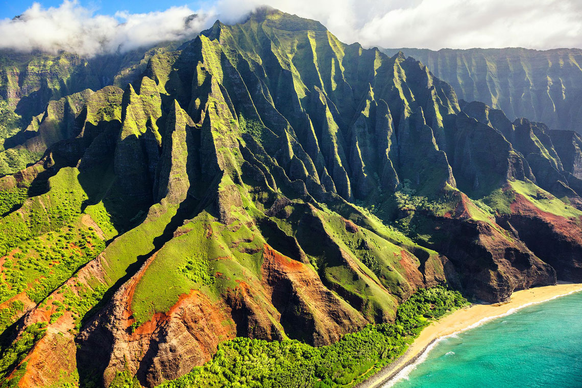
Kauai is the oldest of the main Hawaiian Islands, dating back 6 million years. Like other islands in the archipelago, Kauai is of volcanic origin. The skeleton is interesting in that the relief of some regions of its coast looks unearthly.
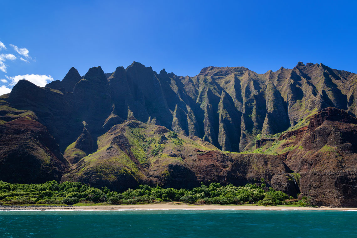
A large amount of precipitation contributes to water erosion. Water flows cut deep canyons in the mountains with many waterfalls. It looks amazing!
At the western end of Kauai, where the town of Waimea is located, the Waimea River flows into the ocean and forms the Waimea Canyon, one of the most scenic canyons in the world. The island is inhabited by thousands of feral roosters and chickens, settled after the destruction of the poultry farm by the hurricane. They have no natural enemies here (unlike other islands of the archipelago, mongooses are not found on Kauai). They can be found anywhere on the island, including in settlements.
The area of the island is 1456 km², which makes it the 4th largest island in the archipelago and the 21st largest island in the United States. The population of Kauai is about 70,000 people. Kauai was the first island in the archipelago that James Cook landed on in January 1778.
Tourism is the backbone of the island's economy. More than a million tourists visit the island each year, about 80% of which are tourists from the continental United States. Approximately one third of all jobs on the island are in service and tourism.
Reynisfjara beach (Iceland)
Valley of the Goblins (USA)
Cave Aven Armand (France)
Cenotes (Yucatan, Mexico)