We continue to travel in search of alien places on our planet. We find these amazing places on all continents of the globe. We wish you pleasant viewing (images increase when you click on them).
1. Wave, USA
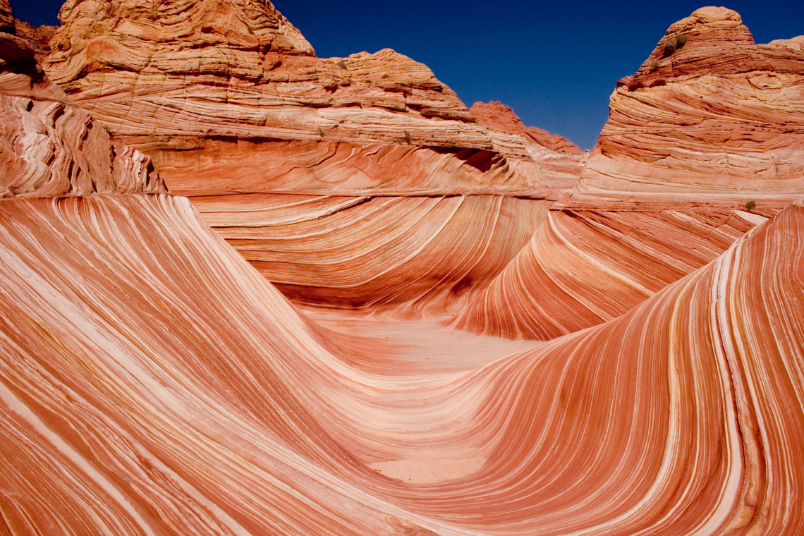
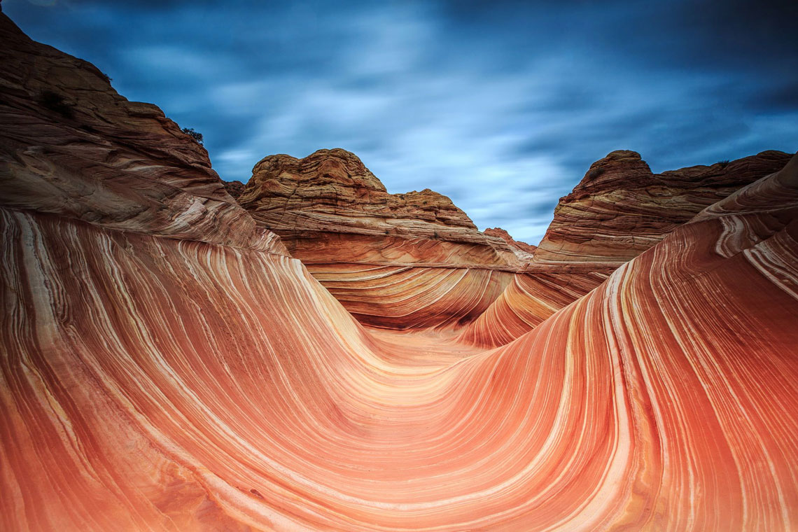
Wave (The Wave) – sandstone rock formation on the border of the states of Arizona and Utah (USA). The wave is known among hikers and photographers for its colorful, undulating forms.
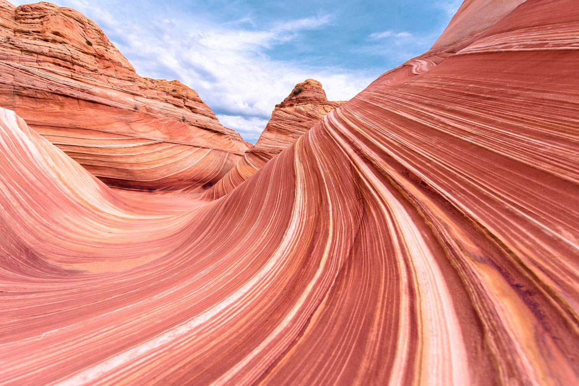
The two main troughs containing this rock formation are 36 meters long and 19 meters wide, 16 meters long and 2 meters wide. 250 million years ago there were sand dunes moving under the influence of seasonal winds. These dunes were composed of different layers of sand with varying amounts of iron, magnesium and manganese oxides, which gave the sand an unusual coloration.
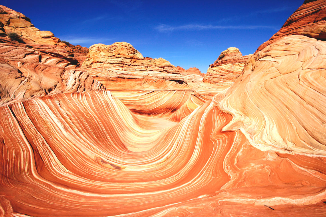
Under the influence of wind and rain for millions of years, a constant process of erosion took place. This is what scientists explain such forms of this wave. After some time, the dunes were compressed and cemented with the help of temperature and water. Then all the dunes were covered with other sand. Sand-filled, cemented dunes stood like this for a hundred million years until the Colorado Plateau rose, and then wind and water blew and washed away the sand.
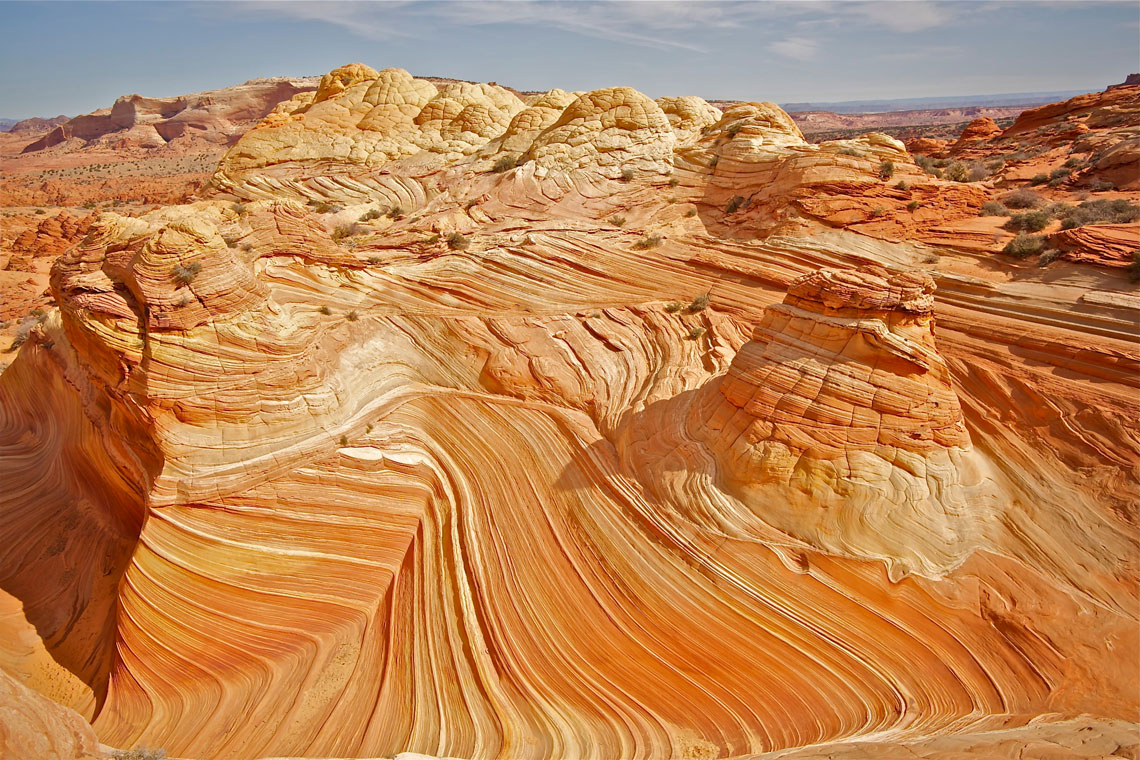
The wave is especially famous among European tourists, in part because it appeared in a German documentary filmed in the 1990s. To maintain the natural integrity of the ecosystem, no roads are laid here.
In order to protect this natural monument from destruction, its visits are regulated by the Bureau of State and Public Lands Management, which limits access to twenty visitors a day.
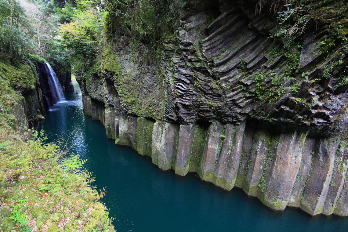
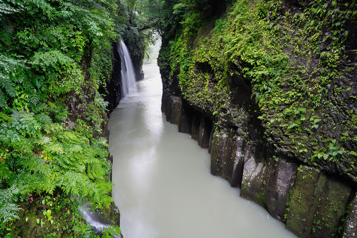
2. Takachiho Gorge, Japan
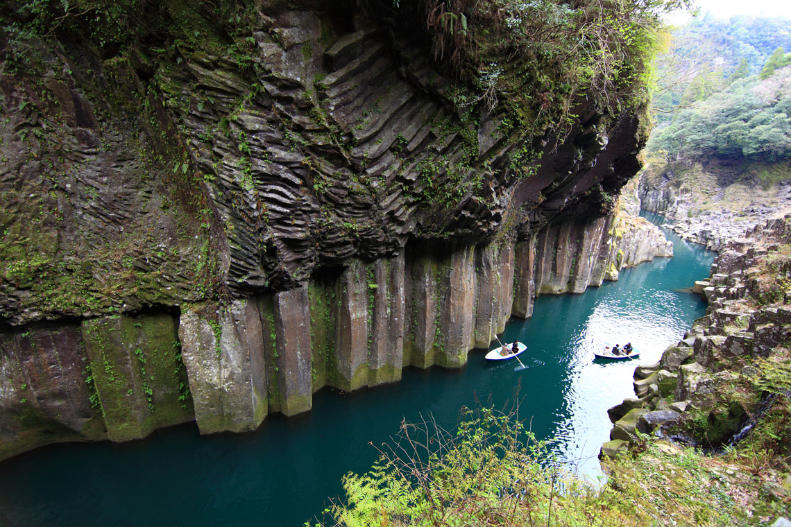
Takachiho Gorge is located in the southwestern part of the village of the same name in Japan and is the main attraction of Kyushu. It consists of volcanic basalt rocks up to 100 meters high, which rise majestically above the blue-green waters of the Gokasegawa River. In 1934, Takachiho was declared a natural monument and is now protected by the state.
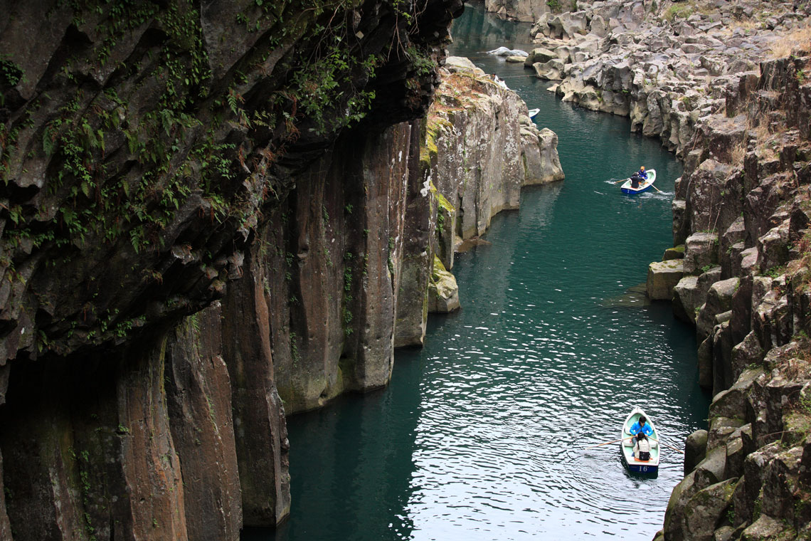
The basalt formations of Takachiho were formed many millions of years ago from the lava of the Aso volcano, between which a stream of water with a length of 5 kilometers made its way. Similar basalt formations we have previously in other parts of alien places:
- The Giants' Road (or "The Causeway of the Giants") in Northern Ireland
- Svartifoss waterfall (or black waterfall) in Iceland
- natural monument of world importance Cape Stolbchaty in Russia
- Reynisfjara beach in Iceland
In ancient times, these places were called the "Land facing the sun." According to legend, it was here, in the Takachiho Gorge, offended by her brother, the Sun Goddess Amaterasu took refuge in a cave, after which darkness reigned on the earth. And only by the joint efforts of many gods was it possible to lure Amaterasu out, which finally lit up the earth and sky with the sun's rays. The gorge is sacred to every Japanese; it is a place of pilgrimage for worshipers of the ancient Japanese pantheon of goddesses and gods.
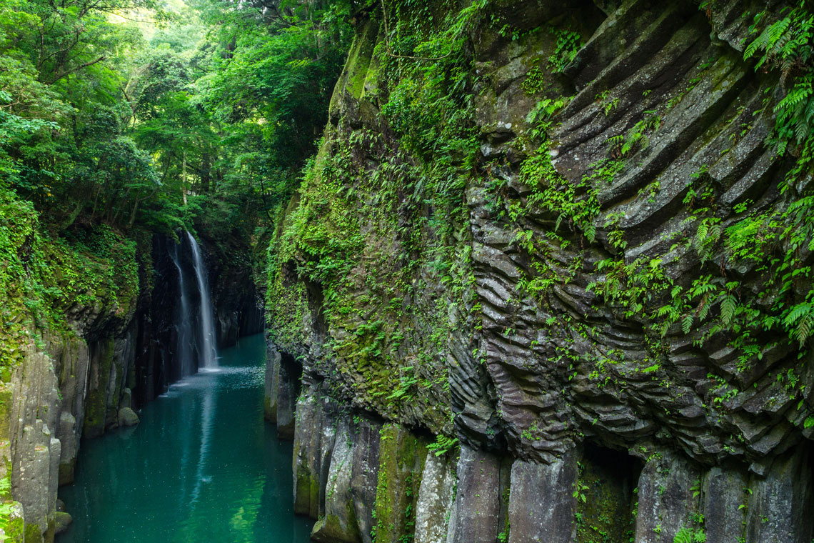
These giant blocks go under water and are reflected in it, sometimes almost touching the opposite shore, leaving only a few meters. Incredibly beautiful oaks and maples, ferns and lianas grow along the banks, and at some point a stunning view opens up of the Manai-no-Taki waterfall, whose height reaches 17 meters.
Tourists here can rent a boat and ride through the gorge, swim close to this waterfall and feel the millions of tiny drops of water. You can also go on a specially laid 600-meter walking route, constantly enjoying the beauty of Takachiho.
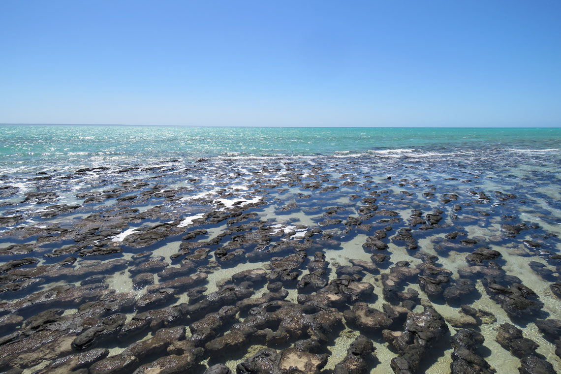
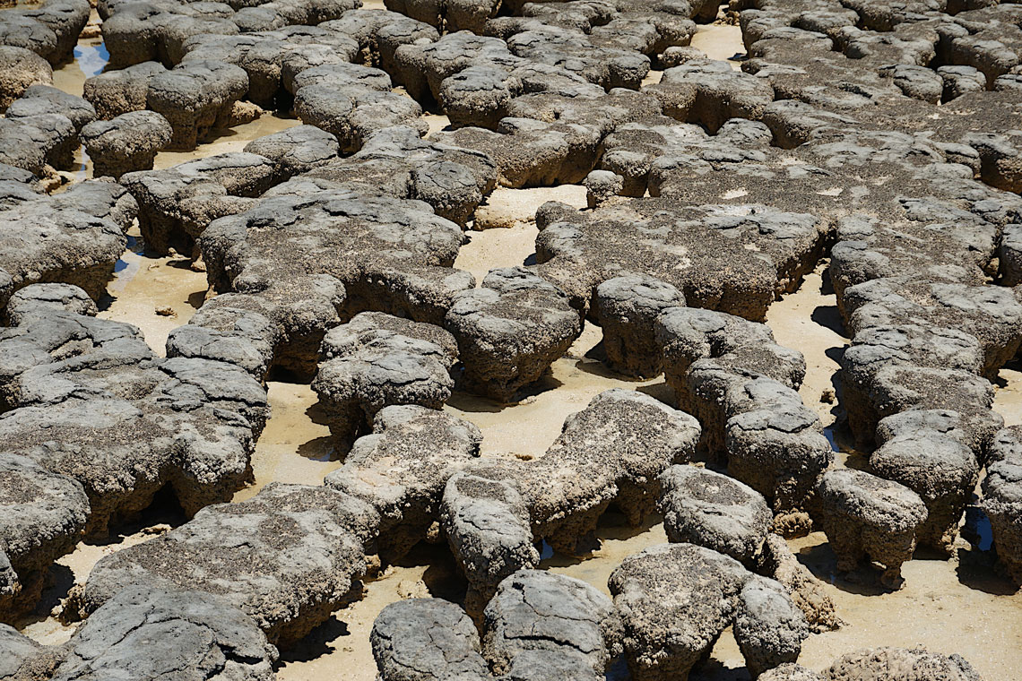
3. Shark Bay, Australia
Shark Bay (or Shark Bay) is located in the northwestern part of the Australian state of Western Australia, located about 650 km north of the state capital, Perth. Today, Shark Bay attracts about 120,000 tourists annually.
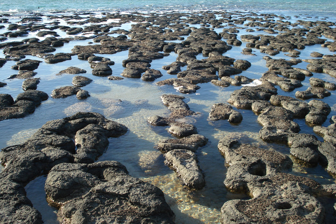
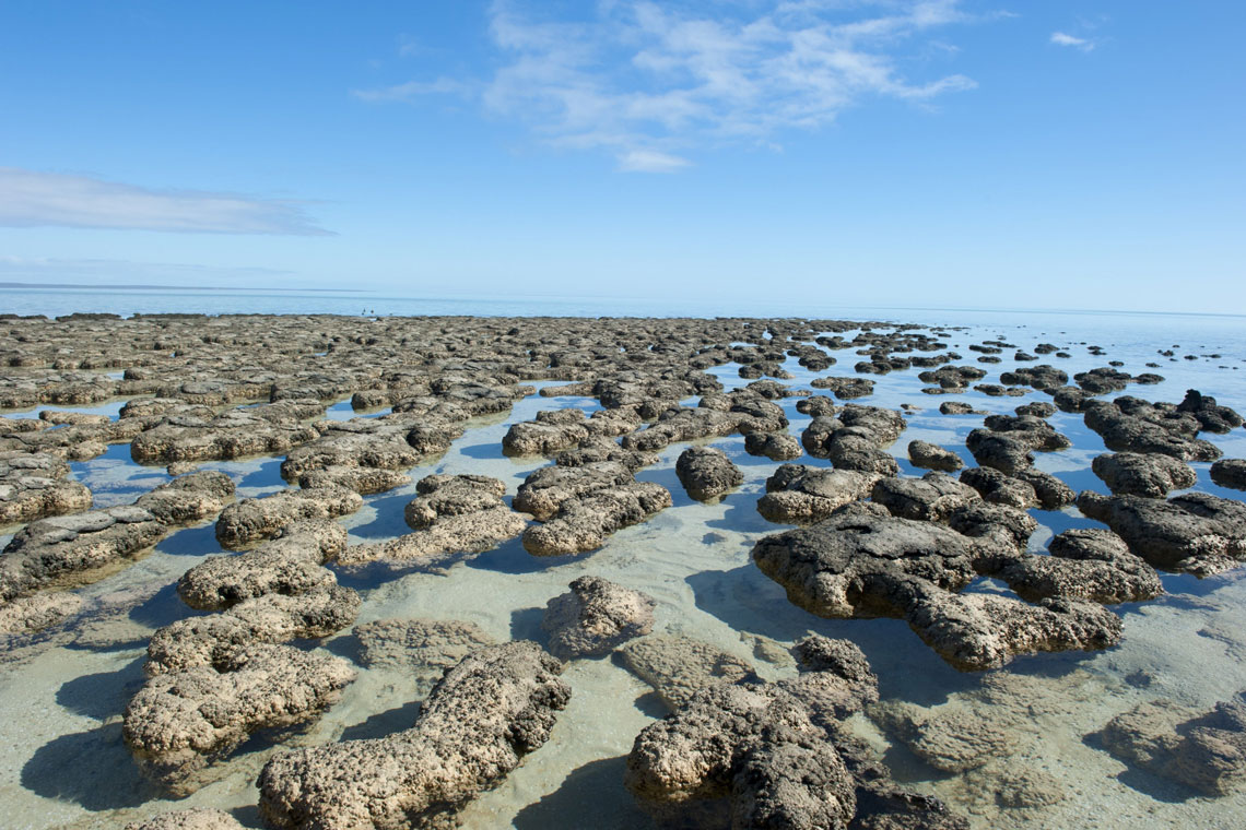
In the southernmost part of the bay is the ultra-salty, shallow Hamelin Pool, the world's largest locality of stromatolites – carbonate formations formed by cyanobacterial mats. Now they are very rare on the planet. The oldest fossil stromatolites are about 3,7 billion years old.
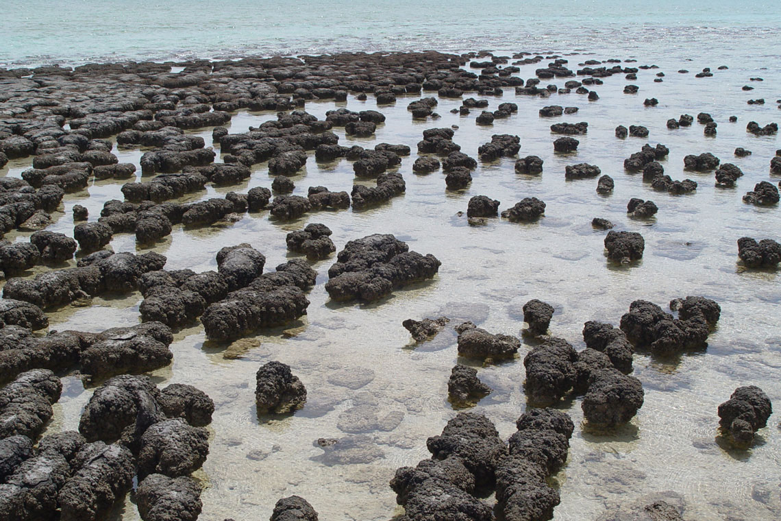
Based on growth rates, it is believed that cyanobacteria (blue-green algae) began accumulating stromatolites around 1000 years ago in the Hamelin Basin in the southern part of the bay. These structures are the modern day equivalents of the earliest signs of life on Earth and are considered the longest biological lineage. They were first identified in 1956 in the Hamelin Basin as a living species, before which it was only known in the fossil record. Hamelin Pool contains the most diverse and numerous specimens of living stromatolite forms in the world. Some stromatolites are thought to contain a new form of chlorophyll, chlorophyll f.
According to one version, Shark Bay got its name due to the fact that the sailors of the ship under the command of the English navigator William Dampier at the end of the 17th century caught a giant shark, which was used as food for the hungry crew. According to another, the most common version, the bay got its name because more than ten species of sharks live in its waters, including tiger and whale sharks.
The bay is a bay with an average depth of 10 meters, which is cut by 2 peninsulas protruding into the Indian Ocean. In 1991, the bay was included in the UNESCO World Heritage List as a unique ecosystem.
4. Elephant Foot Glacier, Greenland
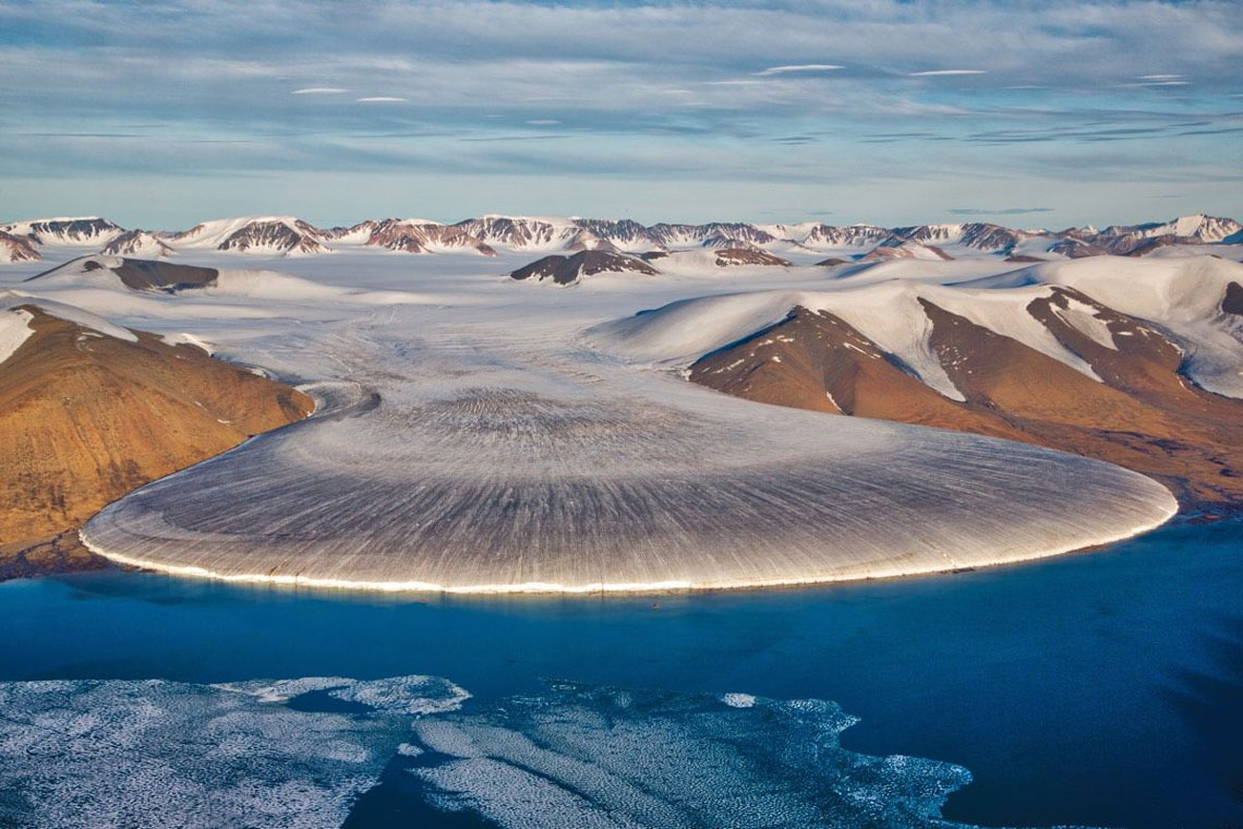
Elephant's foot is a huge mass of ice, which, as it were, flowed down from the gorge of the mountains and formed a large drop. This amazing natural wonder is located in East Greenland and is a popular attraction of the island. Similar types and structures of ice are sometimes found in nature, but not in such an even shape and such a large size.
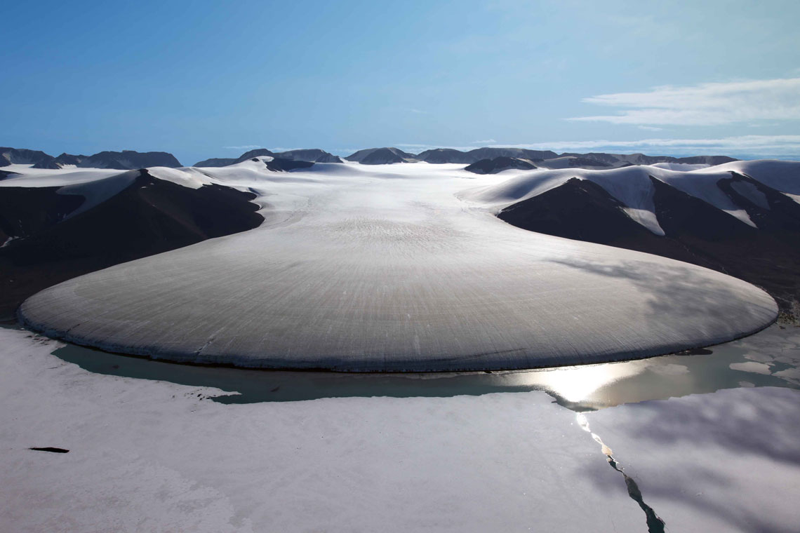
The Elephant's Foot Glacier was discovered during the three-year East Greenland Expedition, which took place in East Greenland from 1931 to 1934. During the expedition, aerial photography was carried out, as a result of which many geographical objects of East Greenland were displayed and named, including the Elephant's Foot.
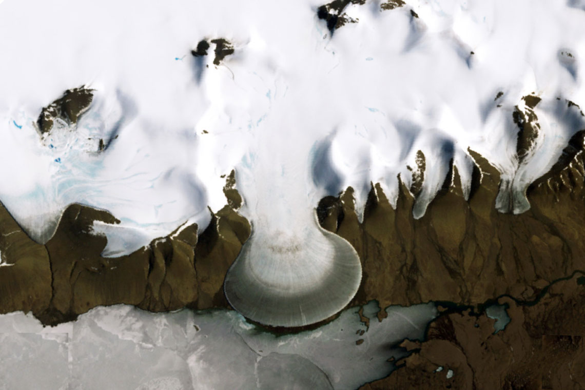
This type of ice arrangement is called a creeping glacier. The reason for such a beautiful shape of the glacier was such a phenomenon as "ablation". In the science of natural ice, ablation means the reduction in mass of a glacier through the process of melting and evaporation, or during the separation of icebergs, that is, mechanical reduction in mass. The Elephant Foot Glacier was formed due to the fact that its northern part, which goes beyond the mountain ring, is in the zone of active ablation. The lower part of the glacier descends from the mountains and spreads over Lake Romere, where the force of the winds and temperature have a much stronger effect on the ice cover. During the day, the ice begins to melt more actively, and at night, layer by layer gradually freezes.
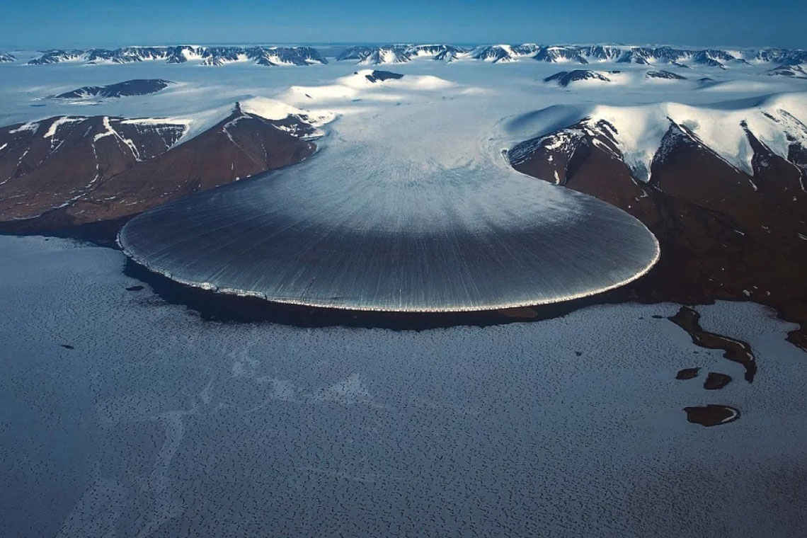
The Elephant's Foot Glacier, like the entire ice sheet of Greenland, is the object of close observation by scientists. The process of global warming is clearly manifested in the change and reduction of the coastline and coastal ice masses. The elephant foot is a celebrity of the northeast coast. Although it can only be viewed from a bird's eye view, the number of tourists who want to see it never diminishes.
5. Aogashima Island, Japan
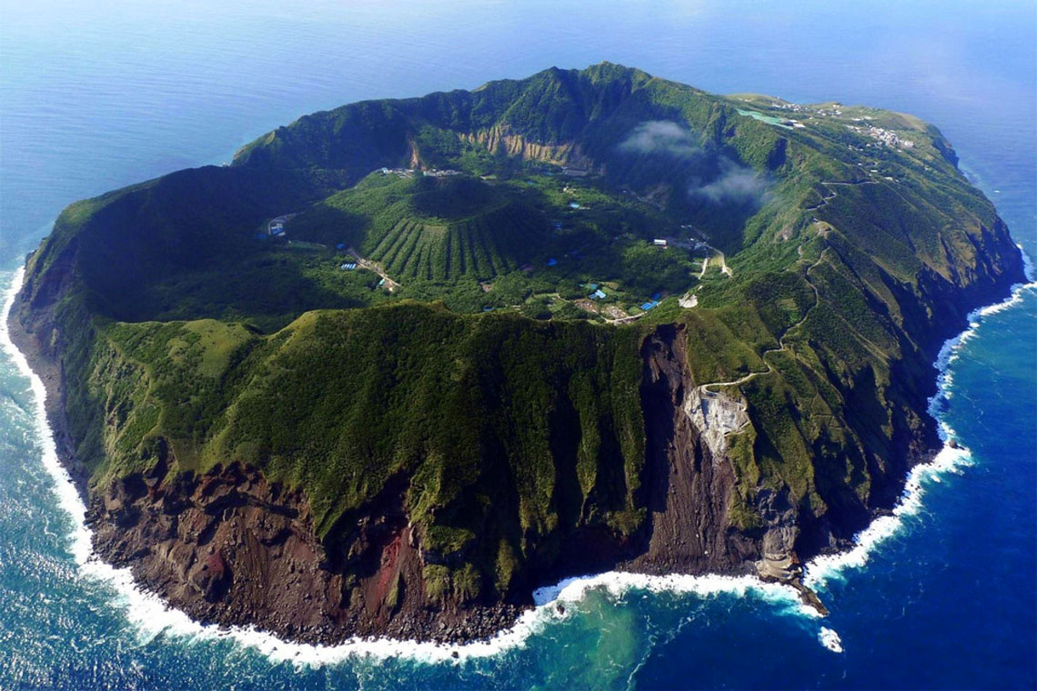
Aogashima is a volcanic island in the Philippine Sea. It is the southernmost and most isolated island in the Izu group of islands. Located 350 km south of the Japanese capital – Tokyo. The island is interesting in that its relief has bizarre alien forms.
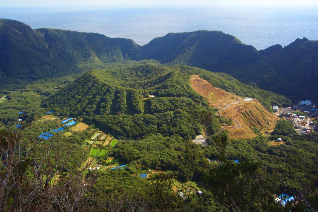
The area of the island is slightly less than 6 km², the length of the island is 3,5 km, the width is 2 km. The history of human settlement of Aogashima is not exactly known. The majority of the island's population is Japanese; The number of inhabitants of the island is about 200 people. The shape of the island resembles an ellipse. The coast is rocky and inaccessible. The climate is subtropical.
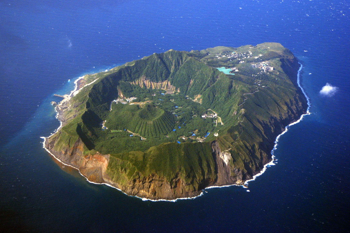
In the northwestern part is the volcano Maruyama with a height of 423 meters. The last major eruption of this volcano was recorded in 1783-1785, when almost all the settlements of the island were destroyed, 140 people died, and about 200 people escaped on the neighboring island of Hachijojima. The coast is rocky and inaccessible. The climate is subtropical.
Wave (USA)
Takachiho Gorge (Japan)
Aogashima Island (Japan)
We also recommend:
◆Alien places of our planet (part 10)